For this month's nature study suggestions at The Handbook of Nature Study blog was to explore ponds and pond-life. Suggestions of focus were dragonflies, frogs, cattails and ducks. We have no public ponds in this county and the only private pond I knew of is my friend, Pat's pond, which is of the man-made backyard variety. Fine for frog and perhaps dragonfly study, but no cattails or ducks. We do get ducks in the tributaries of the Chesapeake Bay and usually some cattails, but not frogs because of the saltwater. With all this in mind, I decided to go to the various places where land meets water in our area and explore the similarities and differences and see what we could find in each and why.

As you know if you have been following this blog for very long, we live a block and a half away from the beach, which we naturally often visit. Betterton is unique in that the water comes from three places: the salty water of the Chesapeake Bay, the fresh waters of the Big Elk Water (labeled C & D Canal on the map because the canal is up that river) and the Sassafras River (the water that ends at Georgetown on the map.)

Because of the placement of Betterton Beach, the salinity levels vary. While both the spring and fall salinity levels on this map show Betterton Beach at having 0-10 salt ppt, which is considered "brackish water", it is much closer to 0 in the spring and 10 in the fall, with the levels varying with variables such as rainfall in between. What wildlife can be found in the different areas of the Bay are determined by these salinity levels. Species which prefer freshwater such as largemouth bass and catfish are commonly found in this part of the Upper Bay. Some species of fish, such as striped bass and croaker, have tolerance for a wide range of salinities and can be found throughout the Chesapeake. Salinity also determines what type of plant life is found in an area. Coontail, sago pondweed and wild celery are common to these fresh tidal waters.
 |
The beach itself is a rocky beach with lots of seaweeds, clam shells and driftwood.
By the way, I have been told (by the Chesapeake Bay Foundation) that the Chesapeake Bay is more accurately called a "drowned estuary" than a bay. A drowned estuary is a partly enclosed coastal body of water with one or more rivers or streams flowing into it, and with a free connection to the open sea that has become submerged under the sea by geological processes. |

Moving further down the coast first map to the next recess, you will come to Still Pond Creek. The name is a corruption of "Steele's Pone," named for an early settler who took up land in the area. ("Pone" is an Elizabethan word which simply means 'favorite.') This creek or inlet is part of the many marshes found along the coastline of the Chesapeake Bay which connect deep water and land and are known as wetlands. Juvenile rockfish, perch, and sea trout are just a few of the fish species which take advantage of the shelter provided by plant cover found in wetland areas. Blue crabs spend much of their young life in the protective confines of the marsh; adult crabs often hide in wetlands after molting while their new shell is still soft. Wetlands also provide food and resting areas for migratory waterfowl such as Canadian geese. Swans, and many species of ducks can typically be found feeding in these areas, consuming rooted plants which are abundant in these shallow water environments. Although we did not see any this time.
 |
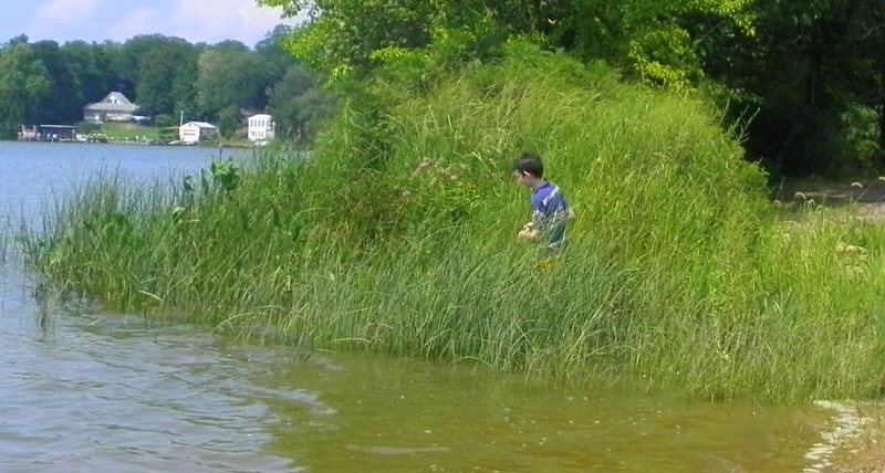
This is one of the places we regularly go for nature walks and is where we did our cattail nature study. Katie helped us collect some again this time..
"As this is primarily a geography lesson, it should be given in the field if possible; otherwise the pupils must explore for themselves to discover the facts...The cattail usually occur in marshy zones along lakes or streams and such a zone is always defined by dry land on one side and water on the other." -Handbook of Nature Study, p. 502 |
 |
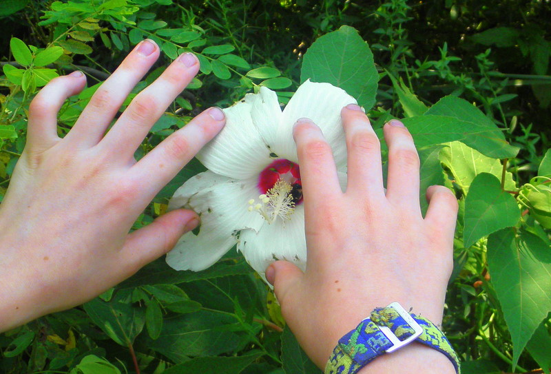
| We saw a Marsh Mallow, which is related to the plant whose pith was pounded and boiled with sweeteners to make the candy that bears its name. |
 |
| At the far left, you can see a bit of some Arrow weed, so named because the leaves are the shape of arrowheads. |

 |
| Dragonflies dart here and there. |
 |
| Student Nature Study Page |
 |
| Student Nature Study page |
But we had yet to see frogs, or a pond, for that matter, so we were off to our friend, Pat's backyard pond...
 |
| where we saw goldfish and water lillies... |
 |
| lotus and |
 |
| algae... |
 |
and frogs!
A perfectly balanced eco-system. |
 |
| We also found deer tracks nearby. |
 |
| We sat down to sketch what caught our interest. |
 |
| Student's sketch |
Through our two-day nature study journey, we re-visited some old friends and became more acquainted with a few more. We compared and contrasted these water habitats and learned what the inhabitants of each habitat got and gave to their eco-system.